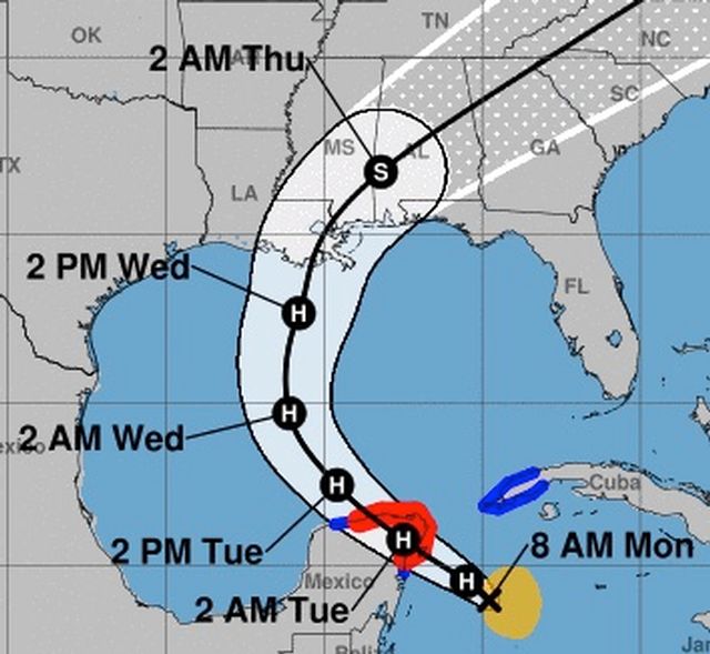
Tropical Storm Zeta Forecast Track Should Stay Away of Keys
The National Hurricane Center forecast for Tropical Storm Zeta anticipates that the storm will move in a northwesterly during the next few days.
The forecast track error cone is well to the west of the Florida Keys and should remain that way, forecasters said.
There are no tropical cyclone watches or warnings for the Keys and none are anticipated, given the current forecast analysis, said Jon Rizzo, the warning coordinating meteorologist for the Florida Keys National Service Office in Key West.
Rizzo said the Keys may get spinoff effects from Zeta that include some rain showers and a few thundery squalls through Tuesday. A few brief wind gusts near 45 mph may accompany the strongest showers and thunderstorms.
A Small Craft Advisory has been issued for the marine areas of the Florida Keys. The advisory means possible wind speeds of 20 to 33 knots are expected to produce hazardous conditions for small craft.
Monroe County Emergency Management is continuing to monitor Zeta, but no protective actions are planned given the current forecast philosophy, said EM Director Shannon Weiner Monday morning. She encouraged Keys residents and visitors to monitor the progress of the storm in the event of unanticipated changes in the forecast track.
Florida Keys National Weather Service

